I can see for miles
Where in Ireland can you see the most counties at once?
There’s a place near my house in Carlow and I’ve been told many times that it’s the spot in Ireland where you can see the most counties simultaneously. They say you can see 6 counties, which you totally can, but maybe you can see more from somewhere else. Let’s check.
First thing to do is go get data on all of counties, and thankfully the excellent townlands.ie project gives us all we need. We can grab the county shapefiles and plot them up
Now we just need to define what it means for us to “see” a county from a given point. Because it would be impractical (read: more work than I want to put into this) to come up with a really air-tight definition I’m going to go with something simple. Say you can see to the horizon from a given point; so we’re discounting any line-of-sight issues, you can see everything within a circle around where you stand. And we’ll make this a little more nuanced by using the local elevation to increase the distance that we can see, if you’re high up you can see further, again ignoring stuff in the way.
To implement this I’ll use NASA’s SRTM data1, which gives us the elevation at every point in Ireland. Unfortunately not all of Ireland fits on one raster tile so we’re missing a little bit data for North Ulster and West Connacht/Munster, but it’s enough for us to work with. With this elevation data, and this simple rule of thumb,
\[d = 3.57\sqrt{h}\]we can get the distance to the horizon given your height.2 So we say that you can see a county if a circle of radius $d$, centred at your location, overlaps with (a reasonably large bit of, no small measures) a county.
Now we can check that place near my house, Palatine
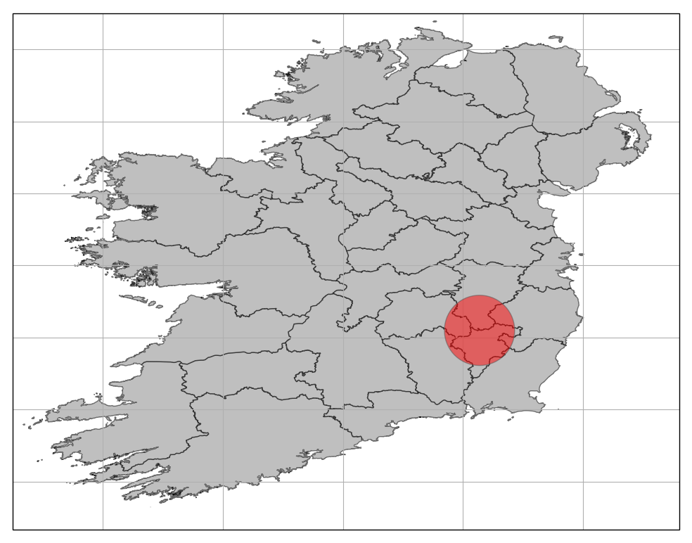
You can see six counties from here according to our code, which agrees with what I can see when I go there! For the curious those counties are: Carlow, Kilkenny, Laois, Wexford, Wicklow, and Kildare.
How about from the top of Carrauntoohil,
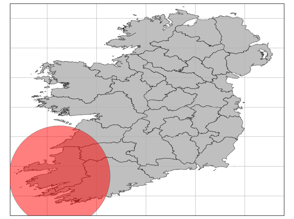
Even though you can see a long way from there, you can only see 4 counties.
So is 6 the best we can do? I’ve run the code over a grid of points, and it seems we can do better. According to the code, you can see 9 counties from the top of Lugnaquilla!3
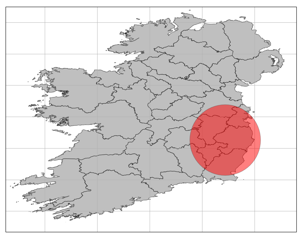
Intuitively this is a really satisfying answer, Lugnaquilla is the highest peak in Leinster and Leinster is the province with the most counties, so you’d expect to be able to see a lot of counties from here.
That said I’ve been to Lugnaquilla and I don’t think you can see particularly far, the line-of-sight is pretty congested by all the other mountains around. I think I’ll keep telling people that the place in Ireland where you can see the most counties is down the road from my house.